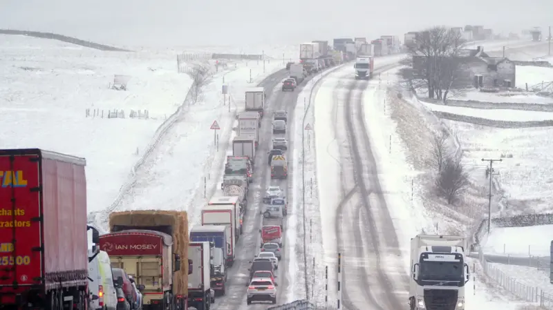
Parts of the United Kingdom are experiencing early winter conditions, with snowfall expected to disrupt road and rail journeys across northern England and southern Scotland on Tuesday.
The UK Met Office has issued a yellow weather warning for snow, which remains in force until 11am GMT, cautioning motorists and commuters about possible travel difficulties.
Between 5cm and 15cm of snow could accumulate in some areas above 300 to 400 metres, while lower-lying locations may record between 1cm and 5cm.
Major roads, including the A74(M), A66 and M62, are expected to experience disruptions, while some railway services could face delays and longer journey times.
According to the Met Office, a weather front moving north and east across the UK is bringing rain to several areas.
However, the system is encountering colder and drier air over northern England, causing some of the rainfall to turn into snow.
The weather phenomenon, known as evaporative cooling, occurs when rain evaporates into dry air, lowering atmospheric temperatures and allowing snowfall to develop over areas including the Pennines, Cumbrian Hills and Scotland’s Southern Uplands.
The agency warned that heavy, wet snow could accumulate on tree branches and power lines, increasing the risk of damage.
Wind gusts of between 40 and 50 miles per hour over elevated areas could also bring down branches and power lines, potentially causing localised power outages.
Snowfall at lower elevations is expected to be short-lived, with conditions likely to return to rain by mid-morning in many areas.
However, higher hills and mountains in Scotland and northern England could experience wintry conditions into the afternoon.
While northern parts of the country are expected to remain cold and wet, southern areas will experience sunshine and occasional showers, with temperatures reaching 14 degrees Celsius.
Rain and showers are forecast to continue across Northern Ireland, England and Wales over the next few days, although improving conditions are expected as high pressure moves in from Wednesday.
The drier and sunnier weather is expected to spread southwards across much of the UK towards the end of the week, although colder conditions, overnight frost and occasional coastal showers are also forecast.